We arrived back home Sunday afternoon after 10 Days through NY and Vermont. What a beautiful place that is. Seems like we just got started when we have to go back home. Oh well, we'll just have to try to go up there again someday.
Anyway our trip took us across northern NY, 4 days camped in Stowe Vermont, then back through Eastern NY, Central PA, and the Shanondoah Valley in Virginia. The posts below are a recollection of the trip with a few photos included. For more pictures please click this link to look at our picture site on Dotphoto.com for the photo album of our Fall 2006 New England Tour. You can also click the "Our Picture Albums" link on the left side of the page under the Favorite Links section.
Please leave comments and don't forget to sign our guest book linked on the left.
Wednesday, October 11, 2006
Sunday, October 08, 2006
On the Way Home
Friday morning came around before we knew it. After getting everything unhooked and cleaned up, we leave our home away from home for the past 4 days. Our planned route will take us down through the eastern side of Vermont along Lake Champlain, then across the river along the shoreline of Lake George NY to Albany. There we will pick up I-88 to Binghampton NY. There we will get on I-81 through Pennsylvania, and Virginia through the Shannondoah Valley, and from there back to Charlotte and home. Hopefully we will have time to stop at the Hershey Chocolate World in Hershey PA.

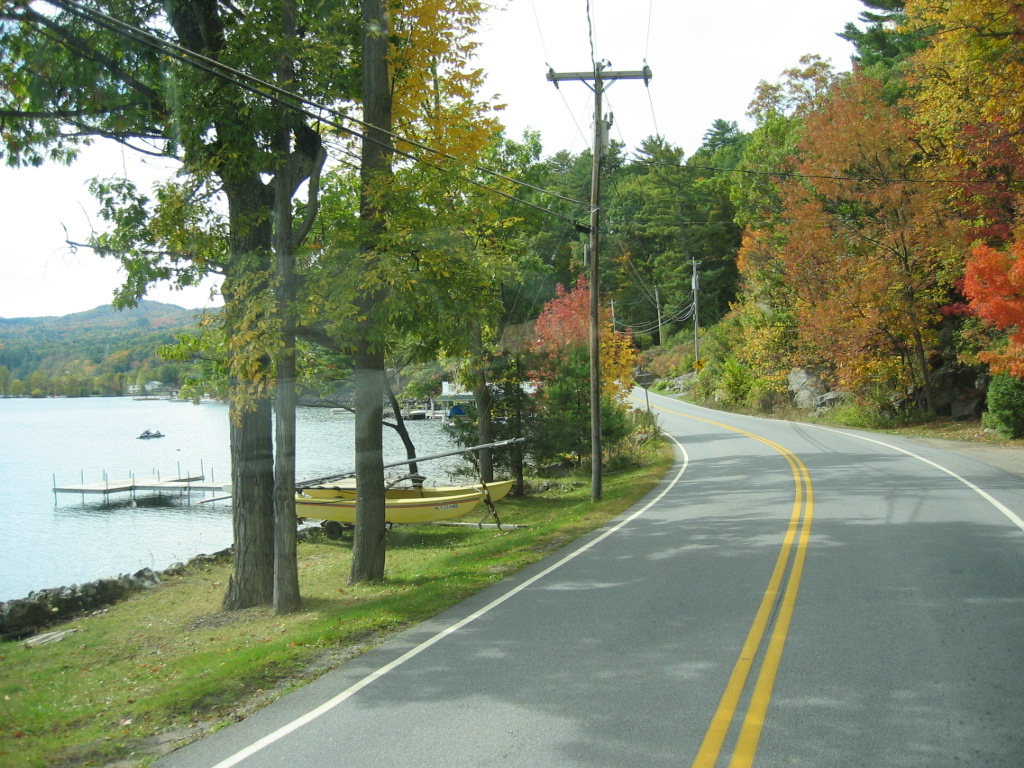
Lake George was beautiful. It is easy to see why so many families have their summer places here. There were even a few sailboats and motor boats out this Friday. Although traffic was very light, it picked up a little later in the day.
After we got to Albany and found I-88 southbound, it was just miles and miles of interstate. I will have to say that it was pretty through there for a lot of the way. Mountains and valleys with the fall colors were still at their peak.
By night, we were in Hazelton PA. Time to think about stopping for the evening, and there happens to be a Wal-Mart nearby. We found the Wal-Mart (finally!). It is not visible from the interstate, and there were no signs pointing the way. In contrast to the place we parked overnight in Massena NY, this place was one of the noiseist places we have ever stayed. There were 3 or 4 other RVs parked there, but at about 5:30 the next morning, we were awakened by the sound of diesels and chains ratteling. Then a tractor roared to life. Looking out the window I see a front end loader pulling up the pavement nearby. It was a pavment repair crew out on this early Saturday morning to get some work done before too many customers showed up. That is enough of a wake up call for us, so we are on the road to Hershey.
The PA welcome center provided all of the maps and borchures we needed to get to the Hershey plant, which is several miles from I-81 on some secondary roads. But when we got there we couldn't believe our eyes. There were cars as far as you could see. They are having a major antique show here this weekend and there must be 50,000 people here. We could get no where near the entrance to Hershey World so we kept on truckin'. But thats OK, that means we will get to a campground in the mountains of Virgina earlier than planned so we may have some time to explore there a little.
Harrisonburg VA is in the mountains west of Washington DC. There is a smaller town - New 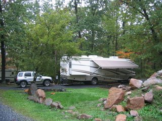 Market VA - located a few miles south of there with a KOA that we decided to try. It is way off the road, about 3 1/2 miles from the interstate down a very narrow little side road through a farm area. This little campground was immacualte, very well maintained, and beautifully decorated for the fall season. We had time to walk around the campground a little, then we asked the manager for a recommended restaurant in the area. She recommended the Blue Stone Inn, just a few miles up the road.
 Market VA - located a few miles south of there with a KOA that we decided to try. It is way off the road, about 3 1/2 miles from the interstate down a very narrow little side road through a farm area. This little campground was immacualte, very well maintained, and beautifully decorated for the fall season. We had time to walk around the campground a little, then we asked the manager for a recommended restaurant in the area. She recommended the Blue Stone Inn, just a few miles up the road.
This place was really a blast from the past. The place was built in the 1920s as a motel with a cafe. The motel or "guest court" (little cottages scattered around behind the restaurant) are history now, although a few are still standing. But the restaruant is still going strong with the same family operating it since the 1940s. They served up some of the best seafood ever. This stopover provided an outstanding last night out for our trip.
So, Sunday morning brings us back through the Shannondoah Valley, to I-77 and the home strech back to Charlotte then home.
All in all, this was a great trip, with good friends. But it left us with enough of a curosity about so much of New England we didn't get to see, that we'll just have to go back again sometime.
Thursday, October 05, 2006
Ice Cream and Maple Syrup
Wow, today is our last real day in Vermont. It seems as though we have planned and looked forward to this trip for months, and now it is almost over. There is still so much to do that we didn't get around to, but I guess that will leave it open to the sequel at some point in the future.
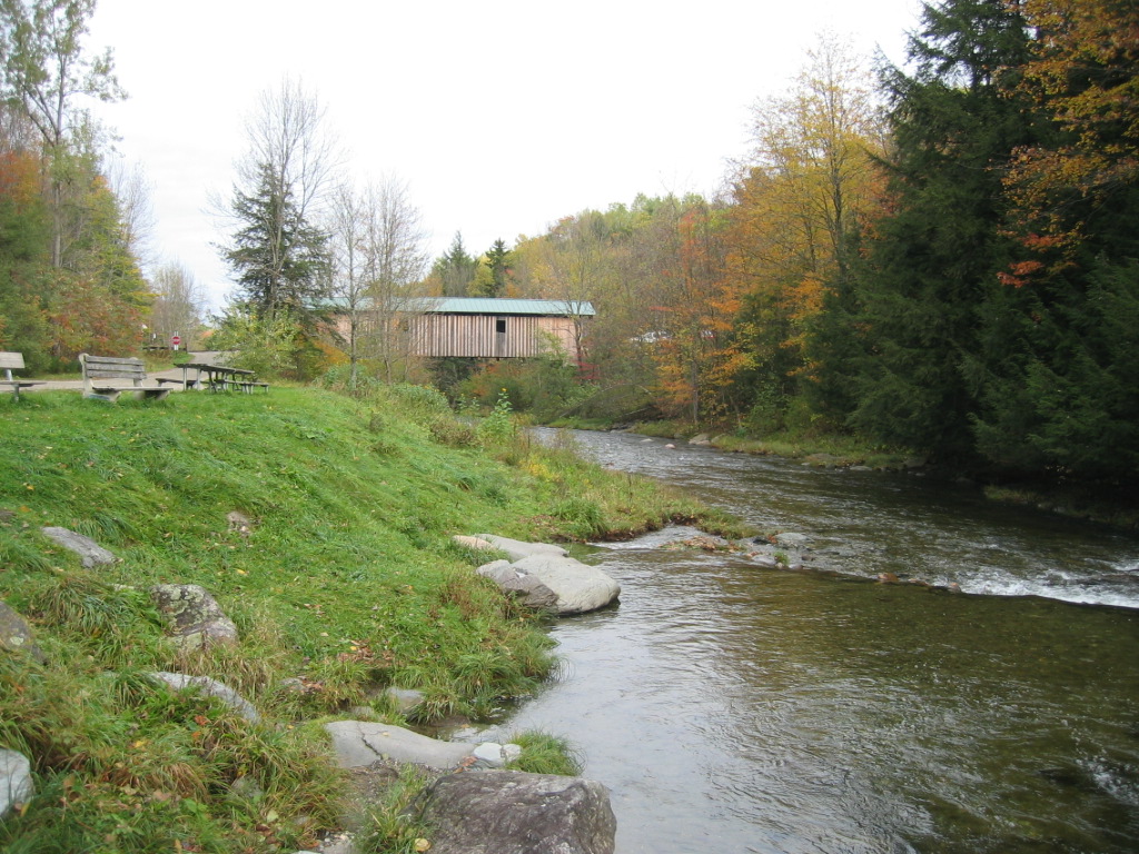
Today's agenda includes Ben and Jerrys, the Cider Mill, and hopefully, a tour of a sugar house. On the way to Ben and Jerrys, we decide to stop off at a scenic waterfall that we have pasted several times. It visible just as you exit I-89 at the Waterbury exit (Route 100 north). Each time we pass it, we decide to stop and take a look,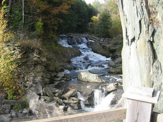 but never took the time. So now is the time. Traveling south on Route 100 almost to I-89 then left just before the ramp, then an immediate right through an older residential and commercial area of town. There is an old mill near the waterfall that has been converted sometime past into a reataurant. However there is a small park area just behind the mill/restaurant with a sign up inviting you to go and enjoy the view. Out back of the restaurant there is a platform built over the edge of the creek where you can see the water rushing down the rocks for about a 15-20 foot drop into the little pool right behind the mill. We are not sure what kind of mill this used to be as there is no signs or anything else we can see to provide that information, just the quaint view, and time for a couple of pictures.
Today's agenda includes Ben and Jerrys, the Cider Mill, and hopefully, a tour of a sugar house. On the way to Ben and Jerrys, we decide to stop off at a scenic waterfall that we have pasted several times. It visible just as you exit I-89 at the Waterbury exit (Route 100 north). Each time we pass it, we decide to stop and take a look,
 but never took the time. So now is the time. Traveling south on Route 100 almost to I-89 then left just before the ramp, then an immediate right through an older residential and commercial area of town. There is an old mill near the waterfall that has been converted sometime past into a reataurant. However there is a small park area just behind the mill/restaurant with a sign up inviting you to go and enjoy the view. Out back of the restaurant there is a platform built over the edge of the creek where you can see the water rushing down the rocks for about a 15-20 foot drop into the little pool right behind the mill. We are not sure what kind of mill this used to be as there is no signs or anything else we can see to provide that information, just the quaint view, and time for a couple of pictures.
 A little later we are on our way to Ben and Jerry's Ice Cream Factory. This place is obviously a destination in this part of the country and when
 we reach the parking lot the place is already full. We have to go up the hill to the auxilary parking lots where a lot of RV's and Tour busses had parked. The walk down to the factory welcome center takes us past the "Graveyard of Flavors Layed to Rest". There is actually a headstone for some of the varieties of ice cream that they do not produce any longer.
As we approach the large patio/deck area behind the welcome center, we notice that there is a large tent set up with several tables under it. As it so happens, today is the final announcement of the Ben and Jerry's New Flavor Contest winners. This turns out to be a pretty big deal for dedicated B&J fans. Over the past few months of the contest, they have collected over 40,000 entries from fans across the country suggesting a new flavor of ice cream for B&J to make and sell. Today the 5 finalist have been brought to the factory to have the factory make their new flavor and then put it before a panel of expert tasters to determine the winner. There was also an international division with 5 international finalist too.
We bought the tickets for the factory tour and that was interesting - although not nearly as interesting as the Cabot Cheese Factory we saw the other day. I think part of it had to do with our tour guide. He was a teenaged guy that really had a case of the "smart alexs" so to speak, and was not nearly as entertaining or informative as he thought he was.
We were able to sample a couple of flavors of ice cream at the end of the tour which ended where it started in the large gift shop. Outside on the open deck, we just had to visit the scoop shop and buy a cone or cup of our favorite flavor.
Shortly after 1:00 PM the music started and the taste panel for the contest was introduced and got right to their business. After sampling all and making comments on each, a winner was voted. They made it clear that the winner would not necessarily become B&Js next marketable flavor, but it (or any of the others) could be as some point in the future. Then we were able to sample the flavors that had been part of the contest.
Time to walk a little so we went over to the Cold Hollow Cider mill for a look around. Here is a cider press that makes many many gallons of apple cider daily. By the time we arrive, they had finished pressing for the day, but we could still see the press through a large window. Again, there is a large gift shop where all sorts of items from apple preserves, apple jelly, apple cider, apple butter, apple/maple syrup, apple crafts, apple tee shirts... well you get the idea.
After getting our fill of apples, along with several bus loads of folks from Georgia on tour busses, we stopped at a place that sells Vermont Teddy Bears, Chocolate, and of course Maple candy and syrup, and, what else,, more Cabot Cheese. ( I TOLD you we were doing all the tourists stuff today.)
Late in the afternoon, we realized that we still had not been to see a real working sugar house. There is one listed in one of the Stowe area maps that is not too far from here, so we go up the mountain following the directions on the map.
Nebraska Valley Sugar Farm is the name of the place. We arrive at the top of the narrow gravel road thinking that maybe we turned at the wrong place. This is someone's home with a barn and out buildings out back. But there are a couple of cars here, and a small sign pointing to the the sugar house.
As we walk around behind the house, we see the entrance to a building that is the sugar house. Inside it is very small with a desk and kitchen style cabinets around the walls. A small table has a sampling of each size and tyhpe of syrup and candy they sell. There is a lady at the desk, but as it turns out, she is a tourist too. Instructions on the desk indicate that you can buy all you want and payment is honor system. Put your money in the cash box and write down each of the items you buy and their quantity on the sheet of paper on the desk.
It turns out that the people that run the farm also run a construction business, and according to someone we just met, they also teach piano lessons. The ski's and snowshoes stacked outside the back door indicate that there is a lot more snow here than anything we are accustomed to down south. Opening the back door we find the workings of the sugar house...large boiler, stacks of wood cut and cured and ready for spring. Large pans over the boiler where the sap is boiled down to make the syrup. There is also a large filter room where the sap is filtered for impurities. These guys have all of their charts from years gone by posted on the walls around the room, with the statistics on the yield from each year going back to the early 1980s. It looks like they tap more than 4000 trees! Seems like a lot to me, but I know absolutely nothing about maple sap except what I read about in school more than 40 years ago. How much could it have changed since then? I guess that means that they collect and haul buckets of sap down the mountains from over 4000 trees? Wrong!
Looking behind the sugar house we see that there is a large network of plastic piping all through the forest on the mountain side. This network gravity feeds a large holding tank in another building just up the hillside from the boiler house. Sap is collected there, then piped down to the filters and boiler pans as needed. I guess like everything else, they have figured a way to do more with less labor.
We could not walk up the mountain to see how the trees were actually tapped, so if anyone knows how they do that, please leave a comment here and let me know. I'll include that information in an update.
Backtracking down Nebraska Valley Road we take a left up over the hill back toward Stowe. This gravel road takes us through some very pretty farms and eventually to the Trapp Family Lodge. This hugh resort set on the mountainside overlooking the valley is named for the Von
 Trapp Family of "Sound of Music" fame. The place looks like an Austrian lodge and is a busy place here in the middle of peak leaf peeping season. We pause for a few pictures and continue on our route to Stowe.
 Riding through the countryside north of Stowe in search of another covered bridge, brings us to the Foxfire Inn north of Stowe on Route 100. This is where we will have dinner tonight. It is an old house built in the 1800s and has been the home of one of the best Italian food restaurants in the area for many years.
The place is packed (luckily we had called for reservations earlier in the day) and we really enjoyed the atmosphere. Most of the rooms of the old house had tables set up as you would expect of a restaurant, but some were outfitted as private dining rooms for parties, and had a residential feel with large china cabinets, chairs, lamps and a large dining table. A couple of rooms simply were decorated as "parlors" for waiting with sofa, chairs, coffee table,and antique lamps.
I admit I picked this place due to a recommendation I recieved prior to taking this trip, and was a little dissappointed. The food was just not as good as I had expected. It was good, no question about that, I was just expecting more. Maybe we just had so much Ice cream earlier today that it "spoiled my dinner" as my Mama would say.
Now for the sad parting of ways. We have spend the past 3 1/2 days with our special friends from Texas and tomorrow we would have to go home. Their flight leaves at about noon, meaning they would have to leave for the airport at 9:30 or 10:00 AM. And we have a long way to go in the camper tomorrow too to get us back to North Caroling by Saturday night. So we will be saying our goodbyes as we drop them off at the hotel. It has been a wonderful trip, but we are sad to see them go.
But that just means that it will be a little closer to our next opportunity to vacation with them next year.
Wednesday, October 04, 2006
Vermont Rocks!
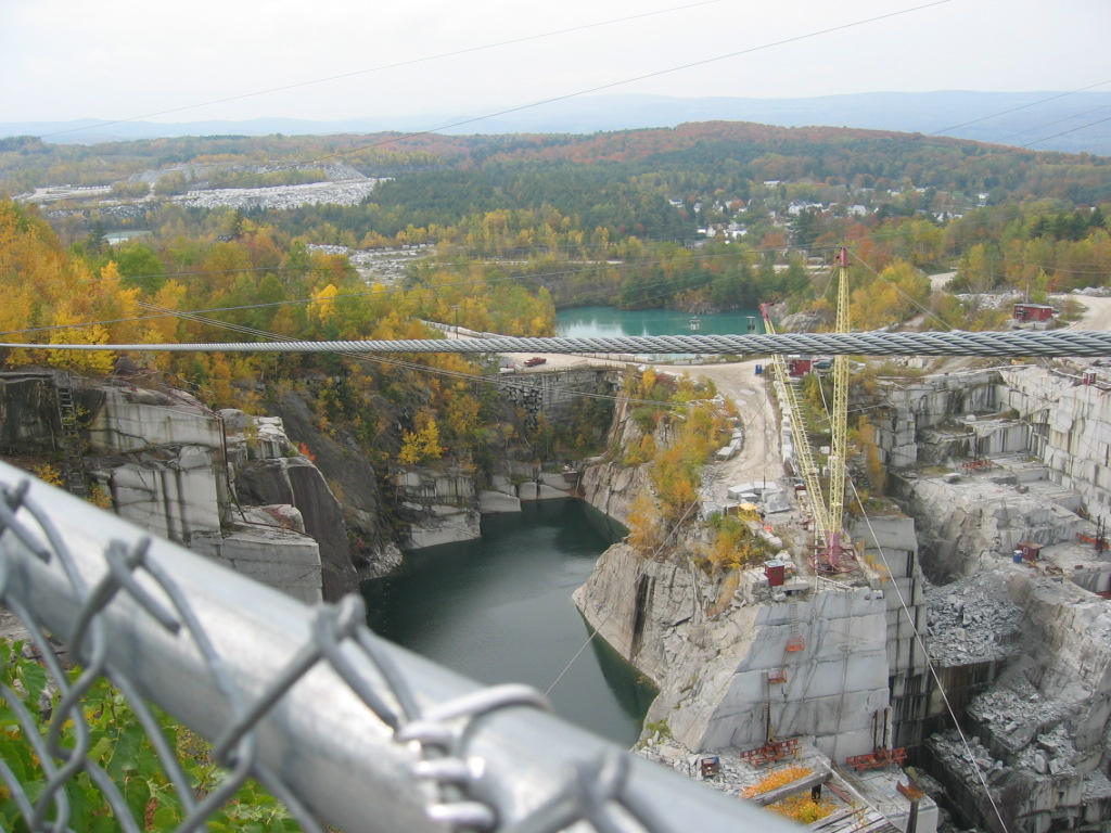
Lots to do today so we get started a little earlier. We have a load of the "touristy" stuff on our list for today and tomorrow. All the usual things: Ben & Jerrys Icecream Factory, Cider Mill, Maple Syrup farm or "Sugar House" as they call it. And maybe some things that are still touristy but not quite so well known, like the Granite Quarry.
Granite Quarry you say? Yep, Granite Quarry. Vermont as it turns out, is one of the premier producers of granite in the world. The history of quarries in Vermont is almost as old as the state itself. We head up the mountains to a place called Graniteville (duh!!!) and see what it is all about. On arrival we find a hugh visitors center with a large parking lot right next to the manufacturing facility. Inside the visitors center is the history of granite in Vermont and a lot of interseting facts and displays. We get our ticket for the quarry tour and wait on the bus to arrive.
The old school bus takes us and a busload of others around the plant and up a mountain road littered with giant blocks of granite. Up top we stop and get out to view the 600 foot deep pit from the top down. This is an operation conducted on a massive scale. Granite here is wholesaled to many companies for various applications. The manufacturing plant here is primarily in the business of producing memorial stones....as in cemetary headstones. They have highly skilled artist that can create all types of artwork on the memorials.
The company Rock Of Ages - has several quarrys in the United States producing specific kinds of granite depending on the area. And what a surprise, one of their quarries is located just up the road from our home. Located in Salisbury NC, is the production facility for Pink Granite. You can read all about Rock of Ages at their great website www.RockofAges.com.

Now for something a little quieter, we head south back into the mountains down Route 14. This road parallells I-89 through the central Vermont mountains. After a failed attempt to locate the famous floating bridge in Brookfield (another case for getting that GPS I'v been wanting.) we stop in Randolph VT for lunch at Patricks. Sandwiches and a big choclate brownie call for a walk around the village. It is mid afternoon and the weather couldn't be more perfect.
By the time we get back to Waterbury just before returning to Stowe, we decide to stop at Ben & Jerrys. But this place is packed with people. The tours are sold out for the rest of the day (it's about 4:30 PM), so we decide it would be better to drop back by here tomorrow when we'll have more time. Arriving in Stowe, it looks like a nice time to just walk around the shops and galleries for an hour or two before going to dinner. Then the rain starts again, out come the umbrellas, and we keep walking and looking. This IS vacation, and a little rain - OK, a lot of rain - is not going to stop us. Dinner tonight is at the Partridge Inn just up Mountain Road a few blocks from the center of Stowe. This was a restaurant that Pam picked and it was very good. Their specialty is seafood and the crab cakes and mountain trout were perfect. Good seafood and great atmosphere. Gee...it is hard to believe that tomorrow is our last day in Vermont! Time flies when you are having fun.
Granite Quarry you say? Yep, Granite Quarry. Vermont as it turns out, is one of the premier producers of granite in the world. The history of quarries in Vermont is almost as old as the state itself. We head up the mountains to a place called Graniteville (duh!!!) and see what it is all about. On arrival we find a hugh visitors center with a large parking lot right next to the manufacturing facility. Inside the visitors center is the history of granite in Vermont and a lot of interseting facts and displays. We get our ticket for the quarry tour and wait on the bus to arrive.
The old school bus takes us and a busload of others around the plant and up a mountain road littered with giant blocks of granite. Up top we stop and get out to view the 600 foot deep pit from the top down. This is an operation conducted on a massive scale. Granite here is wholesaled to many companies for various applications. The manufacturing plant here is primarily in the business of producing memorial stones....as in cemetary headstones. They have highly skilled artist that can create all types of artwork on the memorials.
The company Rock Of Ages - has several quarrys in the United States producing specific kinds of granite depending on the area. And what a surprise, one of their quarries is located just up the road from our home. Located in Salisbury NC, is the production facility for Pink Granite. You can read all about Rock of Ages at their great website www.RockofAges.com.

For all you powertool lovers I have to through in this picture of the biggest circular saw I have ever seen.
Now for something a little quieter, we head south back into the mountains down Route 14. This road parallells I-89 through the central Vermont mountains. After a failed attempt to locate the famous floating bridge in Brookfield (another case for getting that GPS I'v been wanting.) we stop in Randolph VT for lunch at Patricks. Sandwiches and a big choclate brownie call for a walk around the village. It is mid afternoon and the weather couldn't be more perfect.
By the time we get back to Waterbury just before returning to Stowe, we decide to stop at Ben & Jerrys. But this place is packed with people. The tours are sold out for the rest of the day (it's about 4:30 PM), so we decide it would be better to drop back by here tomorrow when we'll have more time. Arriving in Stowe, it looks like a nice time to just walk around the shops and galleries for an hour or two before going to dinner. Then the rain starts again, out come the umbrellas, and we keep walking and looking. This IS vacation, and a little rain - OK, a lot of rain - is not going to stop us. Dinner tonight is at the Partridge Inn just up Mountain Road a few blocks from the center of Stowe. This was a restaurant that Pam picked and it was very good. Their specialty is seafood and the crab cakes and mountain trout were perfect. Good seafood and great atmosphere. Gee...it is hard to believe that tomorrow is our last day in Vermont! Time flies when you are having fun.
Tuesday, October 03, 2006
Introduction to Vermont
We start the day a little later than expected but by 10:00 AM we are on our way. Again it is sunny and then cloudy, but I immediately head up toward Smugglers Notch on Vermont Route 108. The "Gaps" or "Passes" in the mountains that are referred to down south are called "Notches" in the New England Mountains. Smugglers Notch is said to have gotten it's name due to sumggling cattle and other commodities through the area during the Revolutionary Way. However it recieved the name, it is quite a ride there. Route 108 is a typical mountain road winding and twisting up and back through the mountainside. On the way up we pass many people riding bicycles up, others walking or running.
This area is huge in its support of outdoor activities. There are many, many miles of walking, hiking, biking trails through out the state. The Stowe Recreation Path, actually provides a hiking/biking trail from downtown Stowe to the top of Mount Mansefield, the highest peak in the state. The Long Trail, is Vermont's own version of the Applachian Trail traversing several hundred miles of the mountains from the Canadian border to Massachuttes. So it is no surprise that we see many out for their morning ride/run/hike in the brisk fall air.
Suddenly we are at the top, the road narrows to only one lane in a couple of places and twists quickly between the mountain on one side and a few very large boulders on the other. That sure explains the "No Trucks with Trailers" signs we saw down below. A number of bicyclists have stopped here for a water break and a Kodak moment. This certainly is a Kodak moment spot.
We continue on to Route 15 and go east toward the mountains, then north on route 109 to find our first covered bridge. The bridge is one of many in Vermont. Some are relatively new, some are old and have been restored and kept in use, and some have been taken out of service altogether. This one is just off Route 109 and crosses a creek up an unpaved road. Just next to the bridge is an overlook with a parking area next to the creek. After taking a few pictures and walking throuugh the bridge we move on.
For the next couple of hours we just meandered through some mountain backroads in the area with beautiful vistas seemingly around every turn. Shortly after noon we decide it is time for a short break. Up ahead we see a country store on the side of the road an pull in for a snack of  some sort. This is a very old country store but still very much a part of the local community, and definitely not a show for tourists. Inside on the old wooden floor stood racks containing everything from Pepsis and crackers, to canned vegetables, to fan belts, work gloves and snow shovels. They even had a hotplate in back with a couple of kinds of soup of the day, (chowder I think it was) and a lunch plate special. Several people had stopped in for lunch. We found the restrooms, bought a Coke and a bag of crackers, and went on our way. These stores were seen all over the area of Vermont we visited and are still seem to be the center of some of the communities we saw.
 some sort. This is a very old country store but still very much a part of the local community, and definitely not a show for tourists. Inside on the old wooden floor stood racks containing everything from Pepsis and crackers, to canned vegetables, to fan belts, work gloves and snow shovels. They even had a hotplate in back with a couple of kinds of soup of the day, (chowder I think it was) and a lunch plate special. Several people had stopped in for lunch. We found the restrooms, bought a Coke and a bag of crackers, and went on our way. These stores were seen all over the area of Vermont we visited and are still seem to be the center of some of the communities we saw.
 Headed back we see an unpaved road that looks promising, so we take it. For a mile or two it is a normal maintained gravel road, then seemed to get more and more narrow. Finally we see that it turns into a private road so decide we better get back to the main road. This little road took us through a beautiful mountainside with a meadow on one side with a creek running through it. With the sun out now shining through the yellow/red leaves of the many maples, it was a very pretty diversion off the main road.
Completing our loop brings us back to Jeffersonville. We vote to get lunch and we find a spot called 158 Main Bakery...and oddley enough it is at 158 Main Street. Home made tuna salad on fresh baked bread, was not enough for us vacationers, so we had to have a Maple Tart which was more of a Creme Brulee type of custard.. yummie!
After a walk around the rest of the town and through some of the shops and a antique store with a lot of interesting old stuff, we are on the roads again. Back tracking across some of the roads we have been on already for a few miles then into some new territory. We pass a lake with a scenic overlook. There are a few canoes out exploring the far side of the lake. The golden red leaves of the trees of the far side reflect in the water for a captivating view.
Soon we are in the town of Cabot VT, home to the Cabot Cheese Factory. We see the facility at the other end of town with a visitor center in front, so decide to check it out. There is a gift shop selling tickets for the cramery tours...last one for the day in 10 minutes. What luck. We sign up for the tour and sample some of the many cheeses made here in the Cabot Creamery.
Cabot is one of the oldest dairy cooperatives in 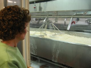 the country. They have expanded outside the local Vermont area and still have hundreds of farms as members. Their primary product is Vermont Cheddar with several veriations and flavors added. The 30 minute tour is very informative. A guide leads you down a hallway with large windows looking into the various areas of the creamery where the cheese is being made. Technology has only increased the volume that can be processed, but it is still the basic routine of cooking the mile, stirring to separate the curd from the whey, draining off the whey and compressing and draining the whey into cheese. Only now it is done in giant kettles and troughs with large stirring and pressing machines, allowing them to make hundreds of pounds of cheese blocks.
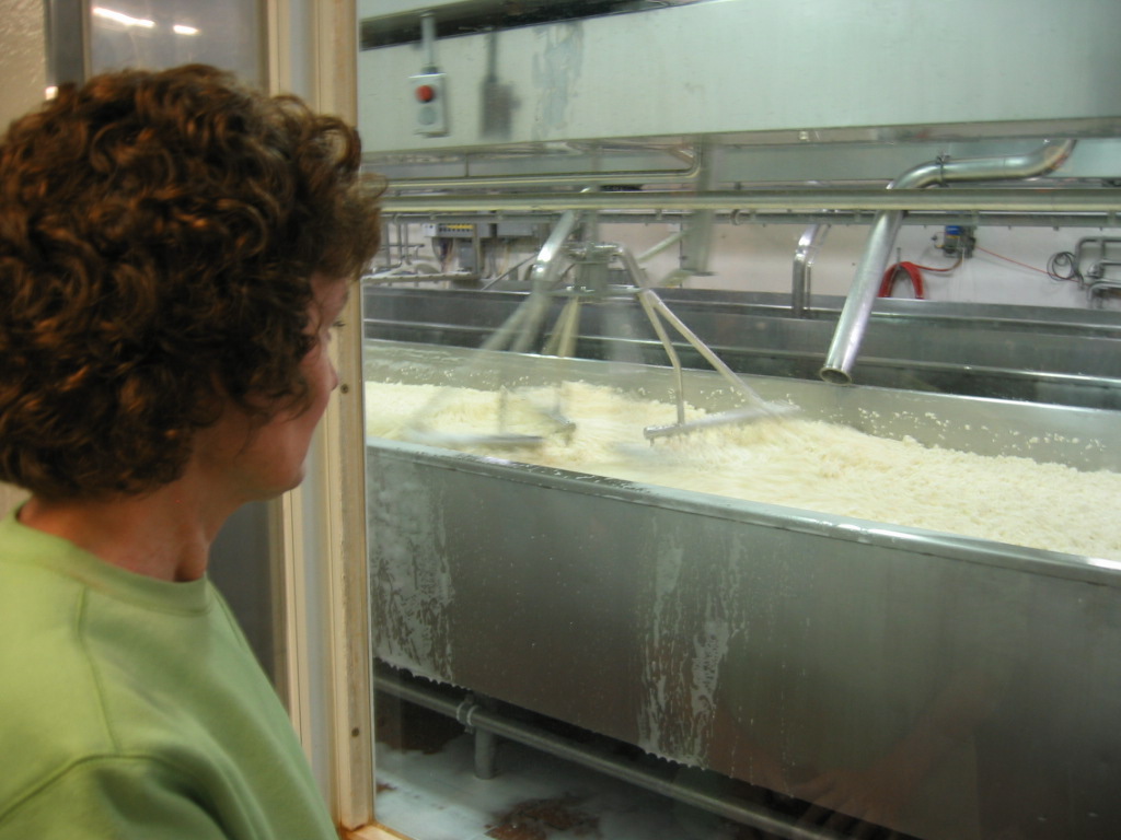 the country. They have expanded outside the local Vermont area and still have hundreds of farms as members. Their primary product is Vermont Cheddar with several veriations and flavors added. The 30 minute tour is very informative. A guide leads you down a hallway with large windows looking into the various areas of the creamery where the cheese is being made. Technology has only increased the volume that can be processed, but it is still the basic routine of cooking the mile, stirring to separate the curd from the whey, draining off the whey and compressing and draining the whey into cheese. Only now it is done in giant kettles and troughs with large stirring and pressing machines, allowing them to make hundreds of pounds of cheese blocks.
 The thing that surprised me the most is the fact that all cheese is white. Well of course, milk is white, so why not. Some sort of color is usually added to the cheese to give it an orange color. Cabot adds a vegtable product for color to avoid any artificial coloring. Maybe other manufacturers to that too, I'll have to look into it later.
Soon we are headed toward Montpielier VT, the state capital. Montpieler is the smallest capital city of any of the state capitals. But after some of the small villages we have been through today, it looks like a thriving metropolis. For the first time, we see new houses in subdivisions being built. Most of the other areas we have been through are old farms and homes, or vacation houses. I guess the goverment and all of the associated service organizations keep employment going in this area. We pass the State Capitol Building with its gold dome set against the mountain in the background.
Soon we are back in Stowe arriving just in time to have dinner at the The Shed. This is a very informal place specializing in steaks, burgers, ribs, and BBQ. We enjoyed our meal there, just up the road a bit from the center of Stowe.
Back at the campground it is about 8:30 PM.. long day, lots of fun, now Bobbi is ready to play for a while.
Monday, October 02, 2006
Lake Champlain Islands
Monday we awoke to the sound of rain.. again. This was without a doubt the quietest Wal-Mart parking lot we have ever been in. Other than the fact that Masenna is a relatively small town, and somewhat remote, this is not a 24 hour Wal-Mart Supercenter. It closed at about 10:00 PM last night and after the few associates left for the evening, we heard nothing. And if the parking lot sweeper came through, the sound of the rain on the camper top must have drowned him out.
There was a little activity around the store when we woke up at about 8:00 AM. Its kind of funny actually, when we open up the front window curtain to see whats going on, we see an Aldi Food Store.
After a quick cup of coffee and a little breakfast, I go out to check the tires, car in tow and see that all looks well. But it it COLD! The rain must have been the escort for that cold front comming through, and it really did chill things down quiet a bit for this southern sunshine loving bunch of campers. I think it is in the mid to lower 40s and that seems pretty cold to us. But with the sun up and the sky clearing, it feels pretty good, just like you would expect fall in New England to feel.
We have not been on the road long when I begin to look for a gas station. I was hoping to hold out until we got to Vermont. Gas prices are pretty high in NY. When we crossed the NY/PA border they were about 25 cents per gallon higher. Our tank holds 75 gallons, so thats $15 dollars or so that I could save. But if we run out of gas on the road.. well that wouldn't be such a good thing. It is not long before we enter the Mohawk Indian Reservation. We start seeing signs for a casino, so I assume that a gas station or two is nearby. And since it is on Mohawk land, the NY gas tax doesn't apply, so it should be a little cheaper. Just in case there are questions about whose jurisdiction we are under, we pass a large sign saying "This is Mohawk Land, not New York Land."
The first station we see is a convience store with the gas pumps lined up in a couple of lanes going towards the store. Not cool! If I pull a 32 foot motorhome pulling a car behind in there, I'd never get out. Finally we see a smaller station with pumps parallel to the road. I get in and begin to fill up. An employee of the station comes out and looks at me kind'a strange, then goes to help the car that pulled in next to us. Thats right, I said "help", as in full service pumping of the gas for the customer. I didn't know any place still existed where there was an attendant pumping gas, I thought those were all extinct now. After he finished with the other customer he walks over to us. I apologize for taking his job over, but he's ok with that and we talk for a few minutes while the 65 or so gallons dribbles into the RV tank.
As usual, we began by talking about the weather. Cold - I thought, but not that cold for the region. Just wait he said.. a few weeks and the snow will start, and it will be really cold. Seems they had had a very wet autumn so far, and were expecting more snow than usual this winter.
He asked where we were from... (not sure why he didn't think we were locals). It turns out that he had been in the military and had lived in Beaufort SC for a few years. After that, he decided to return to NY. "Never could get used to the humidity and the bugs." he said. Coastal SC can get pretty hot and humid in the summer, but it sure doesn't approach 20 below in the winter.
Before long we are approaching Vermont and the Lake Champlain Islands area. The sun is finally out, Pam is settled into her navigators position with Bobbi on her lap, and we are finally there.
The Lake Champlain Islands are very pretty and exactly what you would imagine a New England setting would be. Houses on the lake shore, boat piers behind them, even a few boats (motor and sail) on the water today. The leaves on the trees are spectacular. The road winds down through the islands with the lake first on the left, then on the right, then on the left again. With the trees reflecting from the opposite shore into the water it looks like double colors.
We cross several bridges and the road has taken a more easterly direction. We pass over a couple more bridges and on to a rather small island with the water easily visible on both sides. We have been looking for a spot for lunch, but the pull off up ahead is already crowded with cars, so we keep going.
A little later we are back on the interstate - I-89 between Burlington VT and Montpielier, the state capital. The first rest stop is the Vermont welcome center, so we decide we can't wait another minute and pull in to make lunch. This welcome center had free internet WiFi avaialble, but I didn't try it. I am not sure if other Vermont rest stops have internet access or not.
Soon we are approaching our exit from I-89 onto Vermont Route 100 headed north to Stowe. That exit is at Waterbury VT. On Rt 100 we soon pass Ben & Jerry's Ice Cream Factory, Cold Hollow Cider Mill (all crowded with tourists) and pretty soon we see the entrance to our campground up ahead. Gold Hollow Campground will be our "home" for the next 4 nights.
We pull in to the campground entrance and realize that it is on an old farm in a meadow. This is a beautiful spot with the grassey fields all around and the gold hue of the mountains in the background. We check in at the office and get our site assignment - #73. The manager tells us that the sites have "back to back" utility hookups. That means that the water, electric, and sewer connections for 2 campsites are in the same general spot between the campsites. That also means that one camper pulls into his site, while the other backs in so both can reach the connections. In some campgrounds this is very inconvient, but we have a pull in, and there is a couple of trees, the picnic table and a large grassy area between us and our neighbor on the awning side of our RV. Besides that, after pulling in, the view out our front window is wonderful. No campers or streets in front of us.. only a large grassy field with mountains in the distance. What a view! This is going to be great.
We soon get a call from our friends from Texas. They have arrived at the Burlington Airport and will be heading to their Inn in Stowe shortly. That is only a few miles from our campground.
Let me explain something before going any further. Our friends are very special frinds to us. They are concerned (and rightly so) about identify theft and other internet based identity problems. Therefore, I will not mention their names or any other personal information about them. We have known them for about 15 years and try to visit with them at least once or more each year. The last few years we have been able to get together for a vacation. We consider ourselves very fortunate to have close friends with which we can share special times and special places. So while I will not mention them, realize that they are very much a part of this trip.
We get our call...their flight was uneventful, and they are in their room at the inn (sounds like Mary and Joseph doesn't it...), and we'll go pick them up for dinner in a while.
That will work out fine because Bobbi is about to go crazy spending so much time with us over the past 4 days. Cats really are curious creatures. They sleep most of the day and roam around most of the night. During a normal day, we are working or doing other things in and mostly out of the house. I think getting into the RV with us really bothers her internal schedule. For the first day she is not really sure what we have in mind, so she sits on Pam's lap watching everything go by. Then the first night she is on her usual sleep a little, wonder around alot schedule. The second day out she is beginning to get tired, and seems like she can't wait to get to the campground where she can settle in. When we get to a rest stop for a few minutes, she tries to get in the bed or closet where she likes to sleep during the day. Then when we start up again, she is back up front with us looking like she's thinging "when the heck are you going to stop this moving house and let me get some rest!" So now here at the campground, she is wanting us to just get out and leave her alone for some piece and quiet.
We drive the few miles to the inn and greet our friends. It is really great to see them again. We choose a restaurant that is in Stowe for dinner, a place called Gracie's. Stowe is really a ski resort area. It is one of the oldest ski resorts in the country, maybe the oldest. But the fall "leaf peeping" season as they refer to it, has become larger than ski season. The streets of Stowe are lined with antique shops, gift shops, galleries, and restaurants, not to mention the many inns, hotels, resorts, and the ubiquitious bed and breakfasts that we see everywhere. It sometimes appears that anyone with an old house has turned it into a B&B.
Now I know that some of you are reading this and think I am describing a very "tacky" (I think that is a southern word that means gawdy) area similar to a Myrtle Beach or Gatlinburg TN. But it is no where close to that. All of the resorts and shops are somewhat understated and somehow tend to blend in with the town. No big billboards, neon lights, no Ripley Believe it or Not kind of places. Lots and lots of people though. Downtown Stowe is New England Mountain witht he meeting house/church with the large white steeple on top. Comming down from the mountain the road winds its way through meadows and woods for an occasional down into the valley where you can see to colors of fall and the white spire of the church steeple rising above all else. In spite of the crowds, this is a rather peaceful and relaxing place.
Gracies Restaurant: This is an interesting place indeed. Gracie as it turns out, is not the owner or cook, it is a dog. The whole place is dog themed. After a great meal at a table not too far from a family with a loud bunch of kids, we part ways and look forward to tomorrow, when we can really get started exploring some of the Vermont mountains.
Sunday, October 01, 2006
Across NY from West to East.
Next morning we were a little lazy and didn't get going until about 10:30. Like I said before we had all day today, Sunday, and Monday until 3:00 or 3:30 to get where we needed to be to meet our friends. I had always thought it would be interesting to follow the shore of Lake Ontario, so thats what we do. We cruise past more farms, vineyards, pumpkin patches. There is a lot of very large farms here, and beautiful homes along the Lake Ontario shore.
The shore seems to be somewhat eleveted from the lake itself. It is difficult to tell from the road. Maybe the houses are situated up about 10 to 20 feet above the lake? And there appear to be very few if any with any sort of dock for boats behind the homes. I wonder if that is due to the rough water conditions or ice in the winter. However almost every creek or small bay we cross has lots of boats in it.
One town we go through has a lot of activities going on. Cars are parked along the streets and people walking down the street toward the center of town. We are in Hilton, home of the Hilton Apple Fest. All kinds of food vendors and activities. This looks like it would be a fun stop, and the weather is beautiful. It's a little cool for us, but alot of the people we pass are wearing short sleeved shirts and shorts. Too bad we are not retired yet with unlimited time, we would definitely stop and spend a couple of hours here and get some lunch at one of the local food stands. But we press on.
We are nearing the outskirts of Rochester NY. We go through a smaller town called Greece. We see numerous signs saying "No Greece Soccer Complex." Looks like a politicial battle of some sort. And these signs were all over the place in people's yards. I later found out that there is a youth soccer club with over 450 kids on 26 teams in the area. The proposal was to build a complex with 25 fields and 1700 parking places on 120 acres in the area. Wow! What a large sports complex that would be. With all the traffic those soccer moms would bring, no wonder they want it stopped.
Through Rochester and along Highway 104, on through Osewgo at the end of Lake Ontario, and finally to I-81 south of Watertown NY. Soon we are purring along the interstate headed north...way north... way way north. It is not to long before we cant go any farther north in the US on this road. We can see the Canada border up ahead and we pull off the interstate and head East on Highway 12. Actually the road goes much more north than east. This is rather desolate country and the road follows the St Lawrence River. This is a massive river with a lot of cargo traffic. It is a very isolated looking landscape on the south side where we are, but across the river we can see several large manufacturing facilities. Not sure what they are or what they manufacture over there, but they do take advantage of the river transportation.
We are pretty soon in the Thousand Islands region. The road goes on and on, and we meet very few cars or trucks in this area. I'm sure that during the summertime there is much more traffic in the area, but not now! This area would definitely be worth a visit to spend a little time here. We'll have to put that on a future trip list. Soon we pass through Ogdensburg and are headed toward Massena. There is a state park near there right on the river - Robert B Moses State Park - that looks promising for the evening. As long as we get there before dark we shojld be ok. I don't like having to pull into a strange campground after dark, having to unhook the car and back into a campsite if I can avoid it.
Speaking of Robert Moses, I have to admit ignorance concerning his name. I had never studied NY history, but Robert Moses literally changed the face of NY - for better or worse some say is still up for discussion. Moses was a city/urban planner and archtect. Many of his work projects changed the cities and state in which he worked. For example, he is considered to be the "master builder" of present day NY City and some of it's suburbs such as Long Island. Although he never held public office, he was considered the most powerful man in NY during the 1930 - 1950 time period. He favored highways and road systems over public transportation and as a result many of the highways and bridges in the area now were his ideas. He left his legacy all across the state of NY. Thats why we went to Niagara Falls on the Robert Moses Parkway, and are considering staying in the Robert Moses State park tonight. His name is important to the history of NY.
So now that I know who Moses is, we begin to look for the park bearing is name. According to the trusty campground guide book, I go through Massena, turn left on Hwy 131, go 5 miles then find the park entrance on the right. I hope it is accurate directions because it is getting darker by the minute. We are on 4 lane divided highway in this part of Massena, so it shouldn't be hard to find our turn. Past the Wal-Mart, i see Hwy 131 ahead, make the turn and keep going....hopefully for 5 miles just like the book says. But as we go farther the road seems to narrow and it is looking less and less like we are going to find a campground in this area. On we go, and like a dummy I am not paying close attention to the odemeter, but clearly we have gone more than 5 miles. And there is nothing around here even remoetly looking like a campground or state park. I start to look for a place to turn around, but no such luck. There are a few small houses and moble homes in the area with narrow little driveways. Nothing to pull an RV pulling a car into to do a U-Turn. Now it has gotten completely dark, and this road seems to be headed toward the river. I'm beginning to have visions of comming to a dead end on a narrow back road with no place to turn around...and this road seems to go on and on. Then up ahead I see signs for a junction with Hwy 37. That was the road we turned OFF of after we passed the Wal-Mart a while back. The road we were on made a loop all the way around Massena and now we are about 10 or 12 miles back where we started. Well, at least now we know where we are, and I'm starting to think that that Wal-Mart parking is looking better and better for the night.
After another 15 minutes or so we are back at the Wal-Mart and the rain starts again. Thats it, no state park tonight. The Wal-Mart has a very large parking lot with plenty of room to spare. I find a spot, park, and run it to ask the managers permission. She was more than happy to have us stay the night there. We fixed some dinner and settled down for the night. This was one of the quietest spots we have ever spent the night, campground or not, and before we knew it, it was Monday morning and time to get going again for some more NY and finally Vermont.
Here is a picture of Bobbi that I wanted to share; Does she look like she owns the place or what?
More later...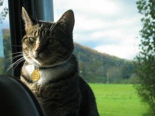
Saturday, September 30, 2006
Niagara Falls
We are finally going to get to see Niagara Falls!
After a restful night, it is time to get going so that we can get to Niagara Falls. Our original plan called for us to get to Niagara Falls yesterday, take the Peace Bridge into Canada and stay at an RV park along the river just south of the falls. However due to the driving and all of the scenery in PA and along Lake Erie, why rush?
So as 9:30 rolls around we disconnect the electricity, reconnect the Tracker and head East. We decide that since it was such a nice drive along the Lake Erie coast last night, we should continue that today. We head up route 5 retracing our track from Dunkirk last evening. But the drive is pretty slow so we decide to cross the NY Thruway and get on Route 20. It is a little faster and will take us to Buffalo a little quicker. Looking at the map it looks like we should stay on 20, to around the east side of Buffalo, then head north. There is a campground I found in the campground guide in Lewiston NY just north of Buffalo. I'm thinking that we should not waste time trying to take the RV into Canada. Lets just find a RV park near the falls on the US side then take the Tracker over to view the falls.
As we get nearer to Buffalo, I decide to get back on Route 5 which will lead us to I-190 back across the river and Grand Island, then north to Lewiston and the Niagara Falls North KOA. The weather is nice today with no rain. Headed north we pass Buffalo with the Niagara River on our left and soon we are out of the city and near Lewiston where we soon locate the KOA. It is on a back road that backs up to an Indian Reservation.
We check in and get settled, have some lunch, then back in the Tracker for our trip to visit the falls. The Robert Moses Parkway follows the river all the way to the Niagara Falls State Park. It is a beautiful drive and just before the State Park entrance is the Rainbow Bridge to Canada. We don't have passports, but according to all the information we could find, a valid picture and original birth certificates to prove citizenship is all we need. I understand that that will change at the end of 2007 and passports will be required. But we have what we need for now so here we go.
The border crossing was simple; a few questions about what we are here for and when we will be leaving, and a "Welcome to Canada."
The falls are awesome! The parkway winds along side the river heading south. Even this time of year there are a lot of people here! The mist from the falls is heavy, and since the wind is blowing from the east, it is like a hard rain as you are just passing the falls. We drive on a little, about half a mile from the falls and find a parking spot. Hourly parking fee listed in both US and Canadian dollars.
We spend the next couple of hours walking around the falls area. It is really difficult to take your eyes off of the site. As we approach the falls from the upriver side the sheer volume of water rushing down the river toward their eventual crash into the chasm below leaves you speechless. This is so much more than just a tourist attraction, it is truley a natural wonder of North America, if not the world. Check our some of our pictures at our Dotphoto.com site.
 Pam at Niagara Falls, with the falls in the background.
Looking down into the falls, an unbelievable sight!

I would NOT want to be on that boat, but it was full of people (that paid a lot of money) to take that ride. And just like they show on TV, they were all wearing their blue plastic rain ponchos. Wonder why?
After a walking to the falls we decide to cross the street to the gift shop and food court. There is a large area of the park with flower gardens and a building housing the food court, gift shops, rest rooms, and the tick window to buy tickets for the Maid of the Mist (picture above) and the "wind cave" tour. This is a cave that takes you down to an area behind the falls. We decided to forgo that little trip in favour of some ice cream and some souviener shoppping. We found a few tee shirts and of course, a set of Niagara Falls thimbles to add to Pam's collection.
Soon we were on our way back across the bridge, birth certificates in hand. What a surprise with the US border guard only asked us for picture IDs. We gave him our driver license and our license tag number. "Have a good day!", and we are back in the US. Soon we are back to the campground. It is dark and getting a little chilly, so instead of going back out to eat, we finish up the tuna casserole we started last night and call it a day. Ummmm , now I have to decide where to to tomorrow. We'll have all day Sunday and Monday until 3:00 PM before our friends from Texas meet us in Vermont. We'll just take it easy tomorrow and not try to drive too late in the day.
Campground Review:
Our campground is the Niagara Falls North KOA. Here is there website: Niagara Falls North KOA. All in all, it was a nice if a little overpriced, overnight stop. It is located very close to the Robert Moses Parkway that goes right to the falls. The parkway is like the Blue Ridge Parkway in that it doesn't allow commercial traffic.
The campground owners were very friendly and offered information on the area and touring the falls. They also pointed out local stores and gas station where we could fuel up. The campground was a little tight though. We had a pull through site that made it very easy to get in and out without unhooking the Tracker. The trees were very close though, and I had to drive very slowly and carefully to avoid the trees. Anyway, it didn't take long to navigate through the campground and into our space. Getting out the next morning was a little worrisome. The road in front of us was very narrow and there were campers in the site across from us. With a tree right beside us on our site, I wouldhae to pull straight out as close to our across the street neighbor as I could before making the left turn out to avoid the tree. With a little careful watching and not getting in a hurry, I made it just fine. This really is a convenient spot as a base for touring the falls and I would definitely consider it again if in the area.
Friday, September 29, 2006
Home to Lake Erie.
Well, it is finally Thursday evening and time go get going. We both had to work today, so we didn't get started until about 7:30 PM. We already had everything loaded into the camper, and I hooked the Tracker up behind the Bounder last night, so we really are ready to go.
Pam got home at about 6:30 so after getting a bite of supper we loaded the cat, locked up the house and off we go. We had planned on going up I-77 into West Virginia, taking US-19 at Beckley WV to I-79, then staying on I-79 all the way to Erie PA. Depending on the time we arrive on Friday, we may go into Canada and stay at a campground near Niagara Falls, or if we don't make the time that I think we should, we can stop before getting to Niagara Falls, then go there on Saturday.
It took an hour just to get through Charlotte and northbound on I-77. Rolling north on the interstate we finally feel like we are really going somewhere! By 10:15 PM we are passing through Fort Chiswell and were going Northbound on I-77 AND Southbound on I-81.. really.. check the map! Finally after a slow uphill pull into West Virginia, we were near Princeton WV. I was hoping to get a little farther tonight, but it is about 11:00 or so, and we are tired. There is the sign of a Wal-Mart supercenter just up ahead right off the exit. Pulling in there are a couple of tractor trailers parked but we are the only RV. I check with the manager on duty just to be sure it is ok to park for a few hours to be greeted and assured that it is no problem, just park out in the front of the lot where we will not interfear with customer parking. With that, we hit the sack and wake on Friday morning to a cool West Virginia morning.
Through WV, PA, and into NY
Friday was a full day of West Virginia Mountains (wheew!) and through Pensylvania. With it raining off and on during the morning, we pulled up and coasted down the mountains through WV. Our route took us up I-77, US-19, and I-79. US-19 had some pretty steep hills with plenty of 6% and 7% grades. Just don't get in a hurry when you are driving a gas powered motorhome in those conditions. We frequently slowed down to around 45 on the steepest areas.
We pretty much took our time going through PA. Around Pittsburgh on I-79 was pretty uneventful. We didn't really have any side trips or interesting things we wanted to see in the area, and we were trying to get all the way to Niagara Falls if we could. But after lunch breaks and a fuel stop, we made it to Erie PA at about 5:00 PM.
We pulled off the interstate and took Route 5 into NY right along the Lake Erie shore. Comming over a large hill we saw Lake Erie in the distance merging with the cloudy horizon in the northern distance. Well, it is decision time. Push on past dark to Buffalo and make a border crossing at night without knowing how long that will take, or find a place soon and go the next couple of hours to Buffalo/Niagara Falls tomorrow morning. After a little discussion and consulting the campground guide, we make our decision.
We decided to stay near Erie PA that night instead of pushing all the way to Niagara Falls as I had planned. Lake Erie State Park in near Brocton NY looked like a nice stop and it was. A beautiful park right on Lake Erie.
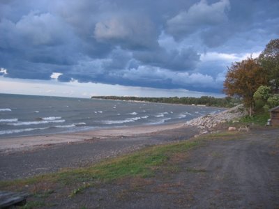
Lake Erie at Sunset
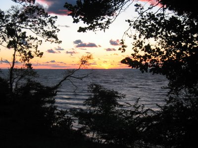
The drive into Lake Erie state park was a beautiful drive. Large vineyards in the large fields bordering the lake, large cattle farms, and fruit orchards. The homes and villages in the area are very scenic. As we approached within a few miles of the state park we saw a detour sign ahead. So here we go back down a little side road with our little Chevy in tow, hoping that the road is wide enough to accomodate us. Finally we get to Hwy 20, a four lane road that takes up closer to our destination.
Low Bridge.. Everybody Down - remember that song from Captain Kangaroo when you were a kid? Well maybe you do if you are as old as me! I kept humming that song as we rode along Lake Erie. Lake Eric State Park is actually close to Brocton NY. We enter Brocton and at the light on Main Street we see a sign pointing left directing us to the state park. But I also notice that the sign says "No Trucks". Ummm.. wonder why? Before committing to the left turn I look down the road and see a sign saying "Clearance 11Feet Ahead". Whoops!... our Bounder is 11 feet 6 inches. I wouldn't want to leave our roof AC units stuck to the bottom of that bridge... so we keep headed north looking for the next truck route to take us back over to Route 5. Finally a few miles up the road we reach Dunkirk NY with a sign pointing north to Route 5. Half mile later we were turning back south on route 5 headed back to the Lake Erie State Park about 6 miles down the road.
It's nice and chilly tonite and it has really rained a lot today before we got to the State Park. Water is standing everywhere, and the wind is blowing right off the lake, making it seem even colder. We check into the campground and get an electric hookup. We didn't realize that the there were no water hookups at this campground, only electricity. There are a few water spigots located randomly around the campground so if you have a long hose or happen to be near one, then you can hookup. But otherwise, you better have a tankfull of water or be prepared to shower in the very cold showers at the bathhouse. Fortunately, we had plenty of water in our tanks. After a short walk around the campground and dinner,we hit the sack after a long day of driving.
Monday, July 31, 2006
OBX!
We just returned from a week at the NC Outer Banks. We stayed all week at Camp Hatteras Campground near Rodanthe NC. What a great place this is. The area in the Cape Hatteras National Seashore is very different from the northern communities of Nags Head and Kitty Hawk. I have not had the time to write about this trip yet, but will try to provide more information on our trip in the comming days. In the mean time, here are a couple of pictures. All of our pictures are available at our dotphoto.com web site: Our Dotphoto.com OBX Pictures.

Our Sound Side Campsite at Camp Hatteras.

Pristine Beaches at Cape Hatteras National Seashore.

Wednesday, May 24, 2006
Edisto Beach
 We have been wanting to try Edisto Beach State Park for quite a while. Back in February I tried to make reservations for a beach campsite and was only able to get a few week days. Thats when we decided to go to Charleston for the weekend then move to the beach.
Edisto is a beautiful place. As you enter the campground ther are many sites that are suitable for tents or small campers. Then the campground opens up and there is a loop with a number of campsites that are near the beach. Even the sites that are not on the beach, are no more than a hundred yards away, so you can't go wrong here.
We left OPC at about 10 AM and arrived at Edisto SP at about 11. But check in time is not until 2:00 we were told. The registrar let us unhook the Tracker and go check out the site we had reserved; #44. Yea.. it was empty. The previous campers were already gone, so we could move in.
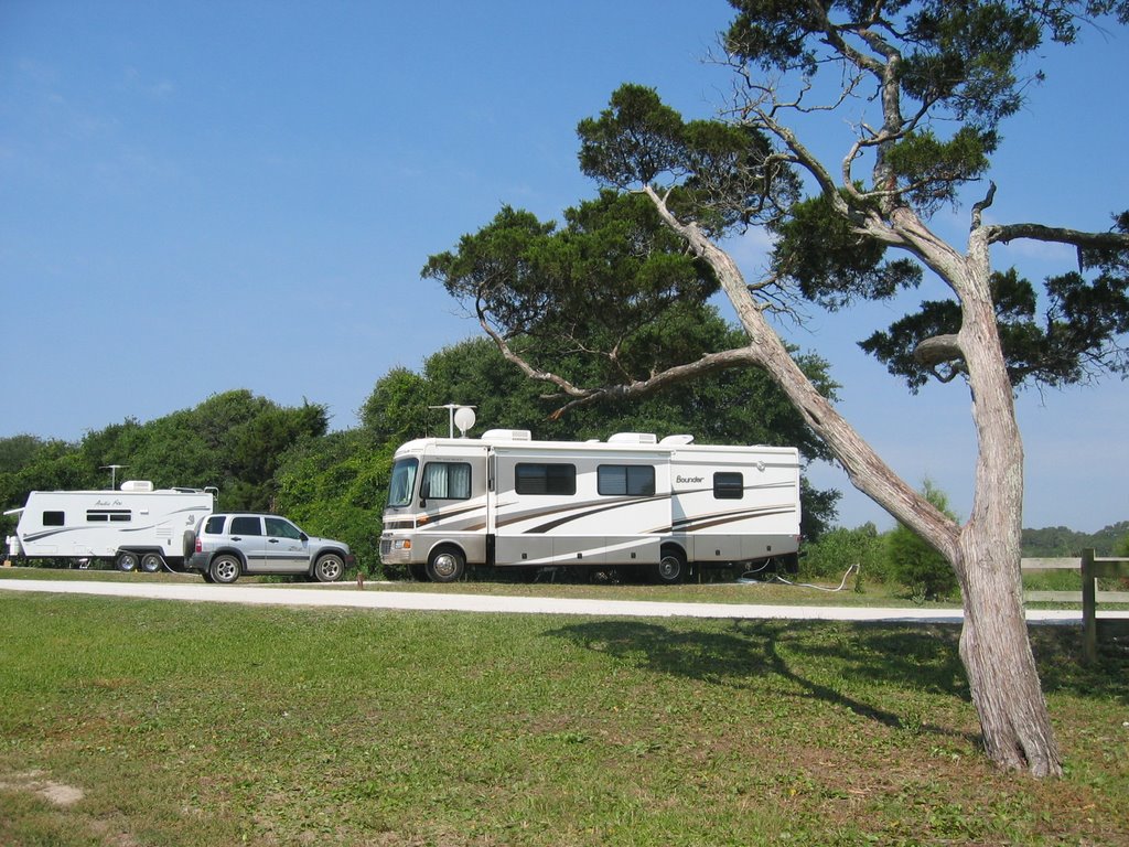
Backing in was no problem and in no time we were on the beach trying out our new umbrella. Pam bought it at the Umbrella Factory near Rockingham NC and it worked great. Hopefully it will last quite a while.
It was rather windy so late afternoon brought a slight chill with the wind comming off the water. We decided to go ride around the island a little and check out a place to get some seafood. Again I call on Roadfood.com and Michael Stern's strong recommendation of the Old Post Office.
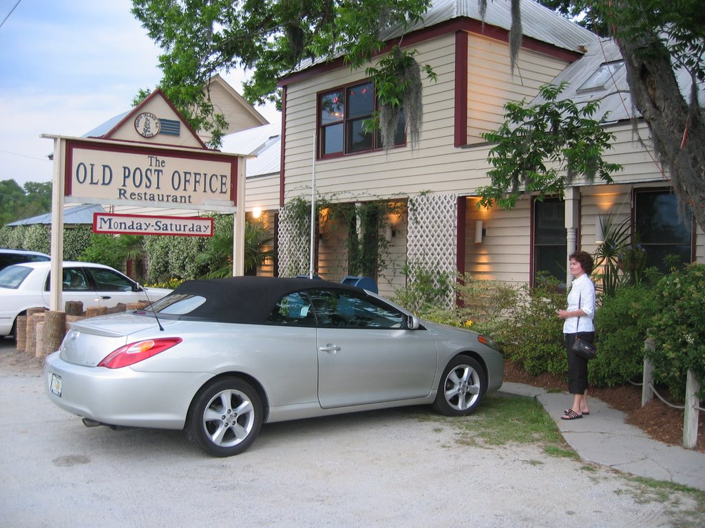
This is an outstanding upscale restaurant with top notch food. Crabcakes were great! It is a meal to remember.
After another cruise around this beautiful island, it was back to our campsite for a late walk on the beach and watching the sunset over the salt marsh right behind our camper. What a beautiful campground this is!
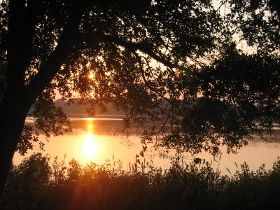
Tuesday was another beautiful day, and we literally spent the whole day on the beach. Reading, watching the Dolphins, talking to other campers, looking at the shrimp boats fising. That night we fired up the charcoal grill for hamburgers and a veggie burger for you know who.
I haven't said much about Bobbi on this trip. Edisto is such a natural place, there were birds of all kinds in the air and on the ground that kept her occupied all day. Her spot is in the front window where she can keep an eye on everything going on. At night, she likes the same spot but she is between the window shade and the window so she can see the activities in the campground.
Wednesday morning we spend as long as we could on the beach, then packed up, unhooked, dumped our holding tanks and were on the way home.
Can't wait to go again!
Sunday, May 21, 2006
Charleston and Edisto Beach SC
Plan Early and Often!
Finally, It looks like we will get to Edisto Beach State Park! Several times in the past we have tried to get reservations at Edisto, a beautiful SC State Park right on the beach about 35 miles south of Charleston. But with the new online reservations system, it is so easy to book these beach side campsites, that most of them are booked an entire year in advance. That doesn't leave much space for us folks that have to plan trips around work and other events. After the FMCA rally in February of this year, I decided to see if I could get a site at Edisto in May. Our wedding anniversery is May 25, so we always like to do a little something special on that date. So after 31 years of maritial bliss(?!) we decided on Edisto.
(Some pictures are posted here. View all of our pictures for this trip at our Dotphoto.com site.)
But even in February no weekend spaces were available that would accomodate our Bounder unless we opted to stay back in the woods a mile or so from the beach.. which is not where we want to be. Checking out the reservations system I did find a beach area site that looked reasonable and it was available on Monday and Tuesday. So why not go back to Charleston for the weekend and stay at Oak Plantation Campground, then move to the beach and head home Wednesday? Sounds like a plan to me, so Edisto and OPC were booked.
Getting Ready to Go.
I am not going to go into all the prep that had to be done to get ready for this trip. After the trip to Florida in February, we did decide to upgrade the toad, so I bought a 2004 Chevy Tracker from Helms Auto Sales in Monroe. The Helms' (Cousins Brad, Bennett, and Uncle Dub) had just what we wanted at the right price. The Tracker is 4X4, 4 Door, and easily towable behind the Bounder. I added a Blue Ox base plate to the tracker and a Blue Ox Tow Bar that is soooo easy to use. It stays on the back of the Bounder when not in use and is almost invisible when removed from the front of the Tracker and only takes seconds to remove. I'll try to write about that on our Miscelaneous page at a later time. I also added a rock guard skirt to the rear of the Bounder to keep road derbis and rock from chiping the paint on the front of the Tracker.
The Tracker is very easy to tow.. just put the 4 wheel drive in Neutral and you are ready to go!
Friday Departure.
Late Friday, May 19 after work we were able to hit the road about 5:00 PM. I was hoping that daylight saving time would give us time to get to Oak Plantation before it gets too dark. Our planned route from Monroe, is US 601 to Sumter SC, then US 521 to I-95, then I-26 and I-526 to US 17 south of Charleston. Oak Plantation Campground (OPC) is about 5 miles south of i-526 on US 17.
With the water tank sanatized and partially filled, gas tank about half full (gas is about 17 cents less in SC), groceries, summer clothes and bathing suites, and the cat loaded we were on the road again. It was a much slower trip than I anticipated. It seemed like every elderly person in Camden and Sumter was out visiting or going to the Golden Corral for dinner. During one segment we followed a big ol' Buick that would not dare go over 35 miles per hour. And of course with the Bounder pulling the Tracker and traffic being what it was, I could not pass, so just settled in for the ride.
We pulled into OPC at about 8:30 PM. The office was closed but they left the directions for out site taped to the door with instructions to come back to the office in the morning to check in and settle up. The sites are very large - spacious is the right word, so we were able to quickly pull in, connect the water and electricity and settle in.
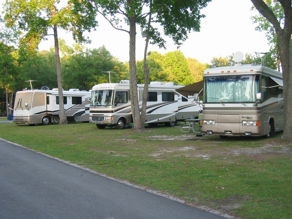
Here we are at Oak Plantation GC in between a couple of diesel pushers.
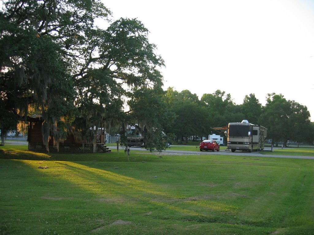
Beautiful sunset through the old oaks at Oak Plantation, Charleston SC.
Saturday we slept a little late, and took our time getting out. About 9:00 I went to the office and checked in and paid up. OPC has what I think is a good policy for reservations and returns. They get a $20 deposit to make the reservation so if something happens and you can't make the trip, you are only out $20. A lot of RV parks get your entire fee up front and may or may not refund if you have problems getting there. I really like OPC. Here is their web site: http://www.oakplantationcampground.com/
Later we took a ride down to a little place called Rockville on the mainland west of Seabrook island, then up to James Island area. We then rode up the Ashley River Road, Hwy 66 past several plantations on the Ahley River. We decided to stop at Drayton Hall Plantation, the oldest continuously occupied plantation in America, according to the tour guide. (http://www.draytonhall.org/. This is a beautiful old place right on the river.
We were able to hear a short program on how slave labor was used to build the plantations and suport the economy of the area during the rice planting era. Then we took a guided tour of the house. The house has not been restored and is being maintained in original condition.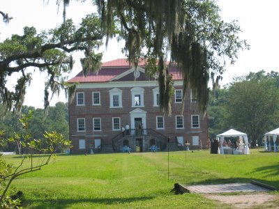
Drayton Hall Plantation on the Ashley River.

Chillin' on the Ashley River at Drayton Hall Plantation
Later we headed back toward Charleston and thanks to the recommendation of Roadfood.com we checked out the Anchor Line Restaurant. This spot is on the Folly Beach road just before crossing the waterway bridge from the mainland to Folly Beach. I say thanks to the recommendations because it does NOT look like a place you may stop without having some advanced knowledge.

See what I mean? The tables are picnic tables on the deck out back. 3 or 5 guys are inside cooking up some of the best fresh fish and shrimp you can imagine.
Sunday morning we went to Fort Sumpter National Park. With all the trips we have made to Charleston we have never made it to Fort Sumpter. This was a great boat trip across the harbour with a beautiful view of the houses along the battery and the awesome new Cooper River Bridge.
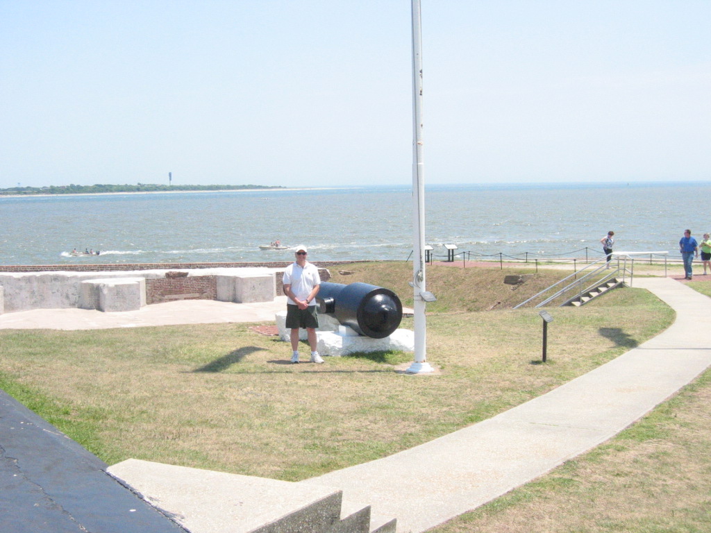
Here I am at the ready, waiting for the Yankee's to return...
whoooops, they are already there! Lots of 'em.
After the few hours to Fort Sumpter and back, we walked around the historic district for a while. We decided we should have a late lunch/early dinner in town then head back to the CG. We tried Hank's Restaurant, but he was closed until 5:00 PM.. and it only 3:00! So we walk back down to Cumberland on Meeting Street and stop in at Diana's for a good flounder sandwich and we had to try some of her Peach Cobbler! Man.. I'm glad we have a lot of walking to do for the rest of the day. Great meal!
Monday, February 06, 2006
FMCA Rally
During the last week in January thru February 5, 2006, we were able to take a week to attend our first Family Motor Coach Association (FMCA) South East Area (SEA) rally. This was the first time we have been able to attend one of the FMCA rallys. Since the rally offically started on Wednesday February 1, we decided to leave home on Friday afternoon January 27. This would allow us to spend several days exploring some of the Gulf coast for a few days before checking into the rally. The rally is held at the Hernando County Airport near Brooksville Florida. My Dad and Mom attend this rally regularly, so we thought this would be a good oportunity to go RVing with them for a change.
Leaving Homosassa on Wednesday morning, we said good bye to our spot on Halls River and headed for Brooksville and our first FMCA Rally. This rally is the FMCA SouthEast Area (SEA) Rally. http://www.fmca.com Mom and Dad have been to this rally many times, as well as other larger national FMCA rallys, and wanted us to join them for this one.
FMCA is the Family Motor Coach Association, and with over two hundred thousand family members, some of the rallys can be quite large. The national rallys held two times per year may have as many as 5000 - 6000 coaches. The SEA rally in Brooksville is the largest area rally. Since it is in Florida in the winter, it attracts about 2500 - 3000 coaches. It is held at the Hernando County Airport.
This airport is an old military facility that was given to Hernando County in the 1980s. It is a very large facility and the County only uses a small part of it for their General Aviation facility. It it is pretty awesome to see thousands of RVs parked on the two 5000 foot runways that are no longer in use.
We met Mom and Dad there on Wednesday afternoon and checked in and parked.
Here we are parked with the Civic next to us. Thats Mom and Dad's Southwind right behind us.

Here is a view up a row of motorhomes.
The rally was lots of fun. It reminded me a little of an old time county fair with vendor and craft booths under a very large tent. And of course, there were lots of motorhome dealers showing the latest and greatest in new coaches. We looked at coaches of all sizes, from $1.3 Million Prevost conversions to very small van conversions and everything in between.
If we were retired........
We are all 3 looking forward to going to another rally in the future.
Leaving Homosassa on Wednesday morning, we said good bye to our spot on Halls River and headed for Brooksville and our first FMCA Rally. This rally is the FMCA SouthEast Area (SEA) Rally. http://www.fmca.com Mom and Dad have been to this rally many times, as well as other larger national FMCA rallys, and wanted us to join them for this one.
FMCA is the Family Motor Coach Association, and with over two hundred thousand family members, some of the rallys can be quite large. The national rallys held two times per year may have as many as 5000 - 6000 coaches. The SEA rally in Brooksville is the largest area rally. Since it is in Florida in the winter, it attracts about 2500 - 3000 coaches. It is held at the Hernando County Airport.
This airport is an old military facility that was given to Hernando County in the 1980s. It is a very large facility and the County only uses a small part of it for their General Aviation facility. It it is pretty awesome to see thousands of RVs parked on the two 5000 foot runways that are no longer in use.
We met Mom and Dad there on Wednesday afternoon and checked in and parked.

Here we are parked with the Civic next to us. Thats Mom and Dad's Southwind right behind us.

Here is a view up a row of motorhomes.
The rally was lots of fun. It reminded me a little of an old time county fair with vendor and craft booths under a very large tent. And of course, there were lots of motorhome dealers showing the latest and greatest in new coaches. We looked at coaches of all sizes, from $1.3 Million Prevost conversions to very small van conversions and everything in between.
If we were retired........
We are all 3 looking forward to going to another rally in the future.
Tuesday, January 31, 2006
Crystal River,Homosassa Springs, Cedar Key
While in the Homosassa area we made a couple of side trips. One of note was to Homosassa Springs Wildlife State Park. This place is kind of like a little zoo but not quite. It is home to hundreds of species of birds and fish, as well as several "resident" manatees. There is also a underwater viewing area. This is built right over the natural springs that feed the river and in the deepest part of the river. You go down a couple of flights of stairs and look through the surrounding glass to see into the clear water. Thousands of fish and several manatees can usually be seen.
This place is also a manatee research and rescue facility and is definitely worth a trip. The flock of pink flamingos was wild...and I thought you could only buy them to stick up in your front yard!

Manatees at Homosassa Springs

Pink Flamingos! (Really!)
According to Jimmy Buffet - "Travis McGee went to Cedar Key". Well, so did Chuck and Pam.
We decided to take a ride up to Cedar Key. It is about an hour north of Homosassa then about 30 miles west. Be prepared to see nothing much but birds and water. It is a beautiful area that is not developed at all. It is what Key West must have been like 40 years ago.
 We stoped at a little place called Annies for a lunch of Crabcake sandwich and a cheesburger (inparadise). Here' s a picture of Pam standing in front of Annies front door. Its definitely not your chain burger joint!
Here is the view from the end of Cedar Key looking west across the Gulf.
Tarpon Springs....
Next day it was raining so we decided to head down to Tarpon Springs and see what was in that area. We drove through a little place called Hudson Beach and found a cool little resturant right on the beach (Hudson Beach Inn and Restaurant) for lunch.
Further on down in Tarpon Springs we found a place to park..no free parking so bring $ for parking in private lots. There are plenty of gift shops with all of the little tacky souviners, but there are also LOTS of sponge shops. The sponge boats unload right there on the streets and many of the shops sell local sponges.
And of course since Tarpon Springs in rich in Greek heritage....Greek Pastry Shops!
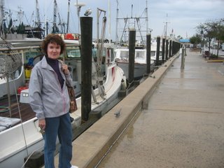
Sponge Boats
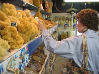
This place is also a manatee research and rescue facility and is definitely worth a trip. The flock of pink flamingos was wild...and I thought you could only buy them to stick up in your front yard!

Manatees at Homosassa Springs

Pink Flamingos! (Really!)
According to Jimmy Buffet - "Travis McGee went to Cedar Key". Well, so did Chuck and Pam.
We decided to take a ride up to Cedar Key. It is about an hour north of Homosassa then about 30 miles west. Be prepared to see nothing much but birds and water. It is a beautiful area that is not developed at all. It is what Key West must have been like 40 years ago.
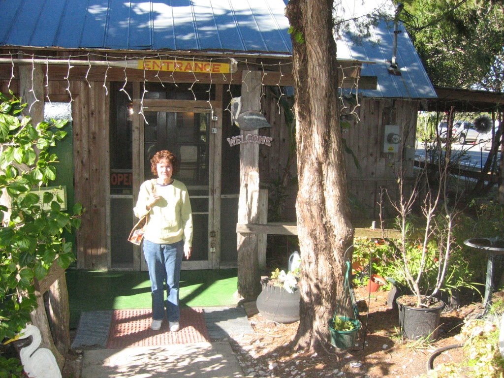 We stoped at a little place called Annies for a lunch of Crabcake sandwich and a cheesburger (inparadise). Here' s a picture of Pam standing in front of Annies front door. Its definitely not your chain burger joint!
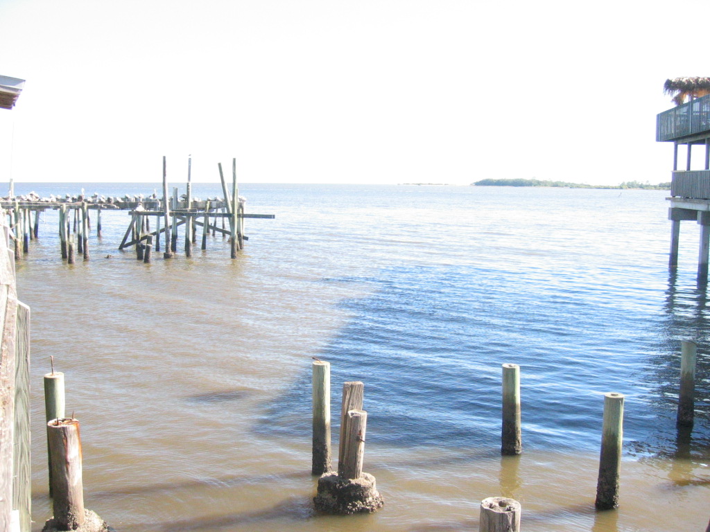
Here is the view from the end of Cedar Key looking west across the Gulf.
Tarpon Springs....
Next day it was raining so we decided to head down to Tarpon Springs and see what was in that area. We drove through a little place called Hudson Beach and found a cool little resturant right on the beach (Hudson Beach Inn and Restaurant) for lunch.
Further on down in Tarpon Springs we found a place to park..no free parking so bring $ for parking in private lots. There are plenty of gift shops with all of the little tacky souviners, but there are also LOTS of sponge shops. The sponge boats unload right there on the streets and many of the shops sell local sponges.
And of course since Tarpon Springs in rich in Greek heritage....Greek Pastry Shops!

Sponge Boats

Sponges and MORE Sponges!
Sunday, January 29, 2006
Homosassa Florida
Saturday takes us down I-95 toward the Florida border. I was looking for that Flying J near Brunswick GA to get fuel. GA fuel is 23 cents less that in NC. Fuel in GA looked to be in the $2.10 range, while in NC it was $2.33.
But we were talking about something or other and the next thing I know we were crossing the FL state line. Oh well.. we'll look for fuel further down the road.
I planned on turning west on route A1A; taking it over to US301 and staying on 301 until Gainesville. I figured that there would be plenty of fuel opportunities where 301 crosses I-10. In this part of Florida you really get the feel for the farming and agriculture that is still a major part of the economy. Most think of Florida as nothing but beaches and giant theme parks (Orlando). But Florida still ranks very high in fruit, vegetable, and cattle production. And you see many horse farms in this area.
Approaching I-10 in Baldwin FL I see several truck stops that will give us an opportunity to fuel up. I pull into the giant Travel America (TA) plaza to find that there are NO RV FRIENDLY GAS PUMPS!!! This crazy place has acres of space for diesel trucks to fill up and park. And even though they advertise to the RV community, their gas pumps were so close to the front of the store that there is no way that an RV could pull into the pumps and turn back to get on the street. Next door is a Pilot truck stop that is the same way. Looking on down the road I see nothing else and I do need fuel, so I do a U-turn and go back to a small BP station/convience store. It is a small lot but the pumps are parallel to the road, so I can pull in, fuel up, and pull back on the highway. $147 later, we are back on the road.
On south through Gainsville, onto Hwy 24 and south we continue. Finally we begin to see some of the lakes and springs for which this part of Florida is known. And the temperature was warming up too. Nice! Getting back up about 75degrees or so really feels good.
Making a left turn onto Hwy 19 we are almost to Crystal River and the Homosassa area. THe traffic is heavy indicating that we are finally in a tourist area. Halls River Road, our last turn before finding the Natures Resort RV Park.
Natures Resort http://www.naturesresortfla.com/ is a quiet kind of place located on the Halls River. The camp store and office is located near the main entrance. A winding road takes you through the cg down toward the river where you find a lagoon (pond), clubhouse and activity room, laundry mat, and a marina store with a little cafe.
We chose a site (there were only a couple to choose from this time of year since it is peak season) that is about 150 yards from the river. We unhooked the car, backed the RV in, and in no time we were in our Homosassa home.
The next thing is to find some fresh seafood. I had spent time on Roadfood.com (http://roadfood.com/) to try to get some recommendations for this area. One of the places is Charlies Fish House in Crystal River. So that was our first stop. It is right on Crystal River and the view was great, as well as the food.
Over the next couple of days we'll explore the area.
Friday, January 27, 2006
Headed for Florida
We have spend most of the week during our "Spare TIme" to get the Bounder ready for our trip to Florida. Last week I was able to get the coach back to Tom Johnson RV in Concord for some warranty service. This included finding and fixing a leak under the kitchen sink, working on the slide mechanisms (they seem sluggish and require you to push the slide switch several times in order to get them completely out), plus several other small items that needed to be taken care of. Most of the stuff was done well, but they still didn't get the slides fixed. My concern is that that will cause something else to go wrong with the slides, but they assured me that its ok. A part has been ordered from Fleetwood that is supposed to take care of this issue.
I also was able to get up to Rowells RV and Customizing last Saturday to get some valve stem extenders added to the rear dual tires. This has taken care of the tire pressure check issues I wrote about earlier.
Most of the evenings this week were taken to load up the Bounder with our clothes and other supplies. Pam cooked several cassaroles that she put in the freezer so we have several meals ready to eat. But I am looking forward to getting some fresh seafood in Florida.
6:10 PM Friday we pull out of the drive way and head south. Since the FMCA rally doesn't start until Wednesday, Dad and Mom will not leave until Tuesday, so we will meet them in Brooksville Wednesday.. so we have several days to explore the West Central Gulf Coast of Florida.. the Nature Coast.
Headed south down Hwy. 601, we intend to stay on US 601 to Camden SC, pick up US 521, then I-95 to FL. After that, I want to take Highway US 301 south to Gainsville then cut cross country to Homosassa. We have reservations at Natures Resort in Homosassa FL from Saturday through Tuesday.
Traffic was light, so the drive was easy. Bobbi was her ususal nervous self the first hour or so, but after that she settles into the routine nicely. Camden is a pretty town, and there we found our way to US501. Sumpter is a little further down the road. The last strech of 501 before getting on I-95 had some major construction going on, but eventually it will be a 4 lane road from Sumpter all the way to I-95.
It was dark when we turned onto I-95, but when you first get on the interstate you really feel like you are traveling! We pulled off at a rest stop just south of I-26 for a very short break and then back on the road again.
By about 10:00 were getting near Savannah and had to decide what to do for the night since I don't drive all night. I did want to leave early so we could get to Homosassa by mid day Saturday. The last thing I wanted to do was pull into a strange RV park after dark. But by 10 we decided to find a place to get some sleep. I knew that Brunswick GA has a Flying J truck stop that we could use for fuel and rest... but that is still well over an hour away. A friend with Savannah coonnections had told me about a Wal-Mart parking lot at the airport exit in Savannah. We found the exit and pulled off. The Wal-Mart had a small parking lot, but the Home Depot next door had plenty of room... and there were already over 20 RVs pulled in there.
We had to circle the lot a couple of times to find an out of the way place to park, and I wasn't sure when the Home Depot opened on Saturday morning, so I wanted to aviod taking any space that early morning do-it-yourselfers might use getting an early start on their weekend projects.
It was a rather noisy place, with trucks in and out all night, and at about 2:00 AM the parking lot sweeper started work, but all in all, sleep was accomplished and by 8:00 AM we had had our coffee and were back on the road.
Editorial: There seems to be quite of emotion in discussions and on the internet forums about spending the night in a public parking lot as opposed to paying for a campground space. I understand all of the sides to that discussion... but for me it is not a matter of money.. it is a matter of convience. Why spend the time finding, getting into and out of, and paying for a space to spend a few hours resting? If the campground owners want to provide that service, then they should have an area within their property that is esentially a parking lot. For a very small fee ($5 - $10), you could park - no hookups, generators ok, in and out. If you need it, for another couple of bucks take water and use the dump station. I think a secure area like this within the CG property would fill that niche.
Subscribe to:
Posts (Atom)


